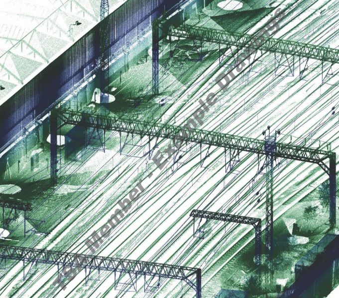
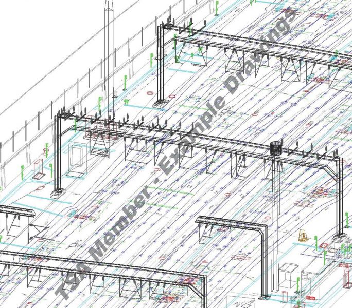
As a general rule, railway surveys are undertaken and presented in 3D. Recent developments in point cloud data extraction have led to diverse methodologies being used to gather survey data while making the most of limited access opportunities. For example, a track measuring device could be used to survey the track position and undertake a kinematic scan at the same time. This could then be infilled with static, or UAV derived point cloud. All datasets are then merged to generate a whole survey, which wireframe models can then be extracted from.
Where elevations are required, these are generally created from point cloud data which is often collected at night. Elevations can either be obtained by the extraction of line-work from the point cloud, or increasingly by creating a 3D BIM model from the point cloud, and then extracting 2D layouts from the model.
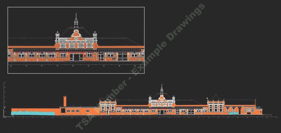
Station topographical surveys tend to be carried out with Total Station, although this is increasingly being integrated with laser scan data capture to minimise time on site. Surveys of stations are often governed by access constraints, with busy stations being surveyed during the night to minimise public interface. In general, surveys will be orientated to a project or route grid and it is often necessary to reference existing trackside control.
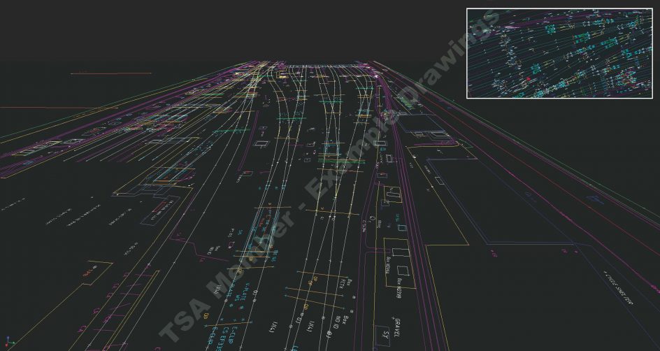
As a general rule, railway surveys are undertaken and presented in 3D. Recent developments in point cloud data extraction have led to diverse methodologies being used to gather survey data while making the most of limited access opportunities. For example, a track measuring device could be used to survey the track position and undertake a kinematic scan at the same time. This could then be infilled with static, or UAV derived point cloud. All datasets are then merged to generate a whole survey, which wireframe models can then be extracted from. This example is the STATIC & KINEMATIC approach.
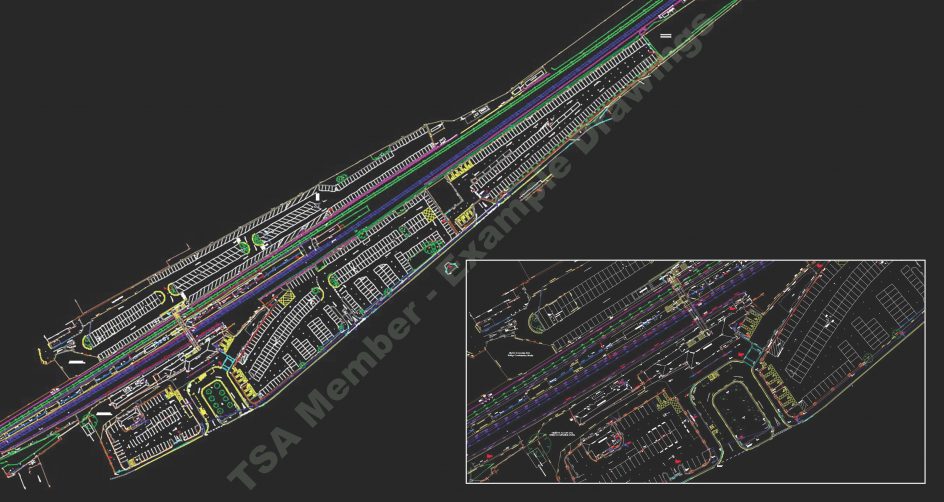
As a general rule, railway surveys are undertaken and presented in 3D. Recent developments in point cloud data extraction have led to diverse methodologies being used to gather survey data while making the most of limited access opportunities. For example, a track measuring device could be used to survey the track position and undertake a kinematic scan at the same time. This could then be infilled with static, or UAV derived point cloud. All datasets are then merged to generate a whole survey, which wireframe models can then be extracted from. This example is the STATIC only approach.
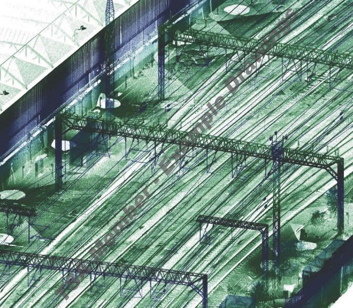
As a general rule, railway surveys are undertaken and presented in 3D. Recent developments in point cloud data extraction have led to diverse methodologies being used to gather survey data while making the most of limited access opportunities. For example, a track measuring device could be used to survey the track position and undertake a kinematic scan at the same time. This could then be infilled with static, or UAV derived point cloud. All datasets are then merged to generate a whole survey, which wireframe models can then be extracted from. This example is the WIRE FRAME only approach.
We use cookies on our website to give you the most relevant experience by remembering your preferences and repeat visits. By clicking “Accept All”, you consent to the use of ALL the cookies. However, you may visit "Cookie Settings" to provide a controlled consent.
This website uses cookies to improve your experience while you navigate through the website. Out of these, the cookies that are categorized as necessary are stored on your browser as they are essential for the working of basic functionalities of the website. We also use third-party cookies that help us analyze and understand how you use this website. These cookies will be stored in your browser only with your consent. You also have the option to opt-out of these cookies. But opting out of some of these cookies may affect your browsing experience.
Necessary cookies are absolutely essential for the website to function properly. These cookies ensure basic functionalities and security features of the website, anonymously.
Cookie
Duration
Description
cookielawinfo-checkbox-analytics
11 months
This cookie is set by GDPR Cookie Consent plugin. The cookie is used to store the user consent for the cookies in the category "Analytics".
cookielawinfo-checkbox-functional
11 months
The cookie is set by GDPR cookie consent to record the user consent for the cookies in the category "Functional".
cookielawinfo-checkbox-necessary
11 months
This cookie is set by GDPR Cookie Consent plugin. The cookies is used to store the user consent for the cookies in the category "Necessary".
cookielawinfo-checkbox-others
11 months
This cookie is set by GDPR Cookie Consent plugin. The cookie is used to store the user consent for the cookies in the category "Other.
cookielawinfo-checkbox-performance
11 months
This cookie is set by GDPR Cookie Consent plugin. The cookie is used to store the user consent for the cookies in the category "Performance".
viewed_cookie_policy
11 months
The cookie is set by the GDPR Cookie Consent plugin and is used to store whether or not user has consented to the use of cookies. It does not store any personal data.
Functional cookies help to perform certain functionalities like sharing the content of the website on social media platforms, collect feedbacks, and other third-party features.
Performance cookies are used to understand and analyze the key performance indexes of the website which helps in delivering a better user experience for the visitors.
Analytical cookies are used to understand how visitors interact with the website. These cookies help provide information on metrics the number of visitors, bounce rate, traffic source, etc.
Advertisement cookies are used to provide visitors with relevant ads and marketing campaigns. These cookies track visitors across websites and collect information to provide customized ads.