Published: 27 Oct 2022
As part of its commitment to informing and educating, The Survey Association (TSA) produces a whole range of Client Guides, Guidance Notes and Briefing Notes primarily aimed at other professionals such as engineers, architects, planners and clients in general. These guides are designed to provide basic information on a on a particular topic, procedure or regulation, which may govern how a particular aspect of a survey is carried out.
Terrestrial Laser Scanning for measurement purposes has seen rapid development over the last 20 years, with it now being commonplace in the geospatial surveyor’s ‘toolbox’. To address these advancements, a revised version of TSA’s Terrestrial Laser Scanning Client Guide has recently been uploaded onto TSA’s website. It provides an overview of Terrestrial Laser Scanning techniques, providing information on what they are, how they are used, and some of the important considerations you should think about before commissioning or specifying a survey that utilises this technology.
What is Terrestrial Laser Scanning?
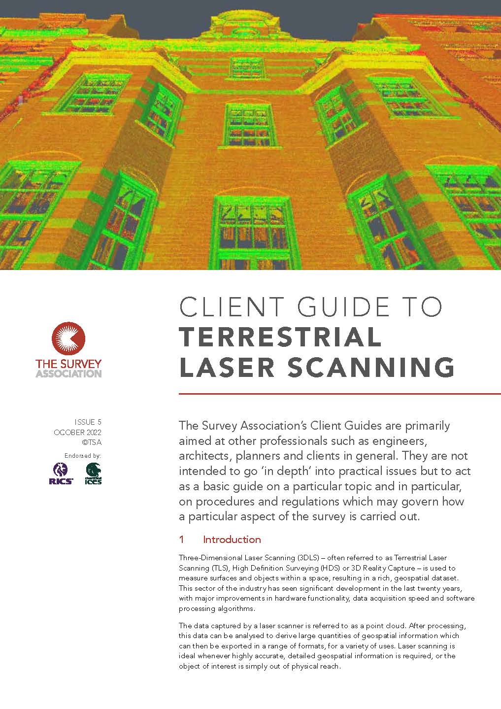
Terrestrial Laser Scanning – which is also known as Three-Dimensional Laser Scanning (3DLS), High Definition Surveying (HDS) or 3D Reality Capture – is used to measure surfaces and objects within a space, resulting in a rich, geospatial dataset. Over recent years there has been major improvements in hardware functionality, data acquisition speed and software processing algorithms. The data captured by a laser scanner is referred to as a point cloud. After processing, this data can be analysed to produce large quantities of geospatial information. Laser scanning is ideal whenever highly accurate, detailed geospatial information is required, or the object of interest is simply out of physical reach.
3D laser scanners can also capture high-resolution digital photography in conjunction with the measured point cloud data. The images can then be overlaid onto the point cloud to show a true representation of the physical world in digital form. Laser scanning collects detailed geospatial data rapidly, facilitating health and safety advantages. Less time is required on site and personnel are physically separated from hazards as data is captured from a safe distance. Laser scanners can also be mounted onto unmanned moving vehicles.
Information from TSA
While the Client Guides provide an overview, TSA’s Guidance Notes are generally aimed at survey companies and clients who require detailed information on a particular subject. This could include where procedures are recommended for specific professional tasks. The Guidance Notes offer ‘best practice’ advice to meet a high standard of professional competence.
Drilling down
The Briefing Notes from TSA are intended to provide information and explanations to members on specific topics of relevance to the profession. However, are not intended to be used for recommendation on professional procedures.
There are over 36 documents available for download from TSA’s website. Client Guides cover a multitude of topics from Aerial LiDAR and Satellite Imagery surveys through to How to Tender and Geological Mapping from Satellite Imagery. Guidance Notes include Network RTK GNSS Best Practice and Railway Surveying, while Briefing Notes cover topics such as Class 3R Lasers and Theft Mitigation Measures.
If you are in the surveying profession or work with surveyors, visit our website and see what resources we have to ensure you get the best survey results: www.tsa-uk.org.uk/downloads