Published: 16 Aug 2023
We often talk about the modern technological advances in the field of surveying, but it’s interesting to look at the origins of the profession too. As long as humans have been building structures, they have needed surveyors to plan and plot the projects. From the earliest days of recorded history, surveying has been part of the construction and planning process.
Many ancient civilisations had their own approach to surveying and it is fascinating to see how these developments took place, independent of one another. It is obviously a case of great minds thinking alike, as the way surveying advanced over decades and across continents relied heavily on geometric theory and trigonometry.
Way back when
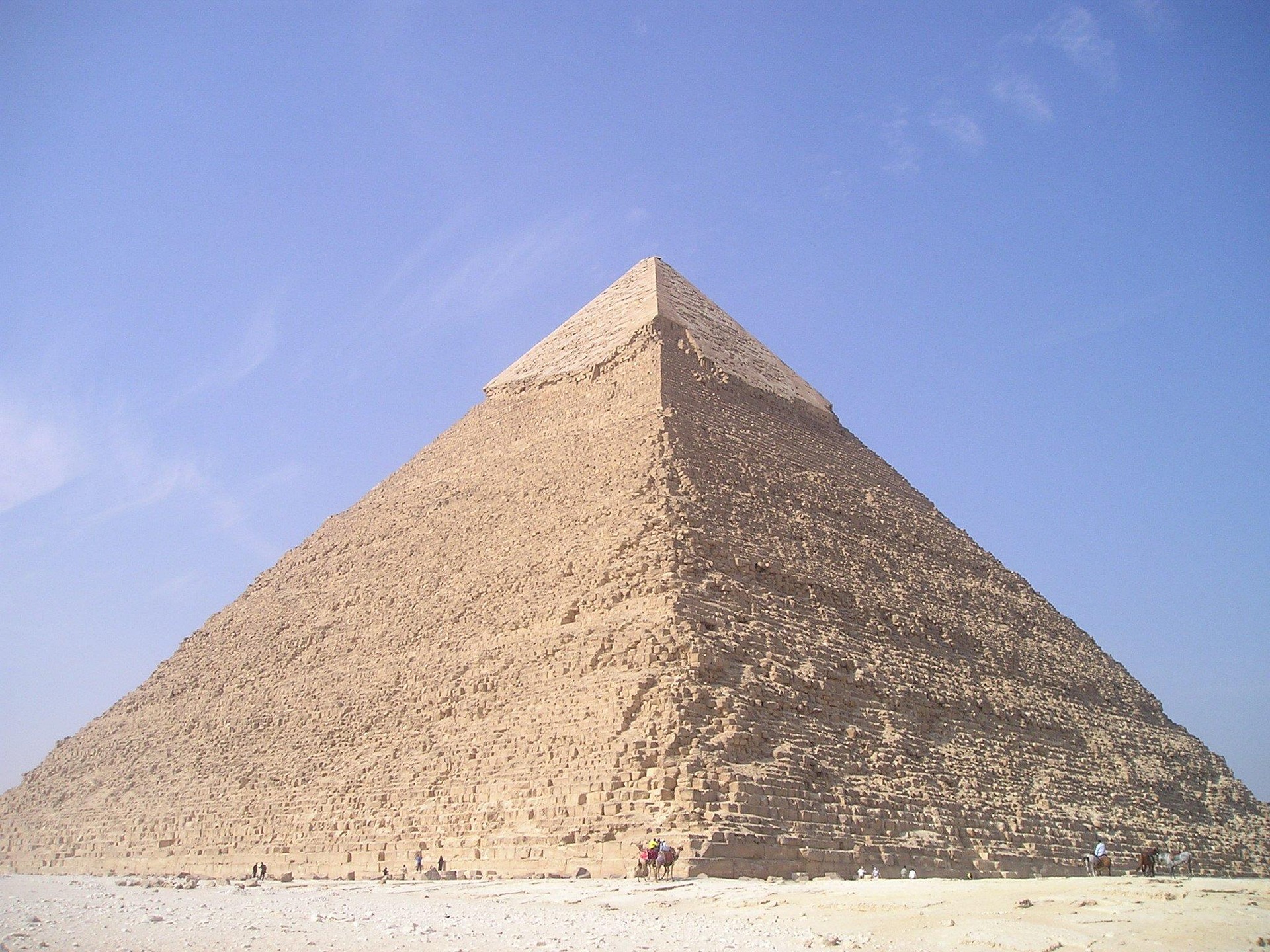
In Africa, the Egyptian pyramids are often held up as a paragon of early construction excellence, ingenuity and a feat of engineering. The perfect squareness and north-south compass point orientation of the Great Pyramid of Giza, which was built around 2,700 BC, demonstrates the Egyptian surveyors’ expertise. They would have used such measuring devices as ropes knotted at intervals to establish equal length, and plumb lines, basically strings attached to heavy weights, to establish vertical levels. In Asia, the Chinese mathematician Liu Hui described ways of measuring distant objects in his work published in 263 AD, which outlined theories that became geometry.
Ancient thinking
Romans, great pioneers in engineering and science that they were, recognised land surveying as a profession, and called surveyors Gromatici. They established basic measurements and ways of measuring and setting out, to be consistent across their empire. The ‘groma’ originated in Mesopotamia in the early First Millennium BC. This was a Roman surveying instrument made up of a vertical pole with horizontal crosspieces mounted at right angles on a bracket. Each crosspiece had a plumb line hanging vertically at each end. This was used to survey straight lines and right angles, and a beadsman – often a slave – would pace out and site a pole at intervals.
In early Britain, the prehistoric stone circle monument at Stonehenge in Wiltshire was set out by prehistoric surveyors using peg and rope geometry around 2,500 BC. In England in 1086, William the Conqueror commissioned the Domesday Book, which quantified the land, but didn’t actually map it. It recorded the names of all the land owners, the area of land under their ownership, the quality and use of the land, and specific information of the area’s content and inhabitants, but didn’t actually include maps of exact locations.
Modern techniques
We’ve come a long way as a profession. By the sixteenth, seventeenth and eighteenth century, practitioners had devised new ways to measure length, height, levels and horizontals. By the nineteenth century, modern techniques and surveying instruments were being used. The British mathematician Jesse Ramsden introduced the first precision theodolite in 1787. It was an instrument for measuring angles on the horizontal and vertical planes. This represented a huge step forward in the instrument’s accuracy. The basic equipment we use today, such as a theodolite and level, became commonplace in the 1800s. Now, with detailed, accurate measuring devices, whole territories and countries could be mapped. For example, in the United States, the Land Ordinance of 1785 created the Public Land Survey System. This formed the basis for dividing the western territories of America into sections, to allow the land to be sold for development and settlement.
The digital, GPS and total station principles and our equipment (such as laser levels and theodolites) that we utilise to collate and evaluate data, have their roots in these historical developments. Each was a step along the path that’s resulted in our current digital equipment. Without this pioneering work, we wouldn’t have the highly-accurate, efficient methods and kit that our members have today.