Published: 21 Feb 2024
About
Storm Geomatics has been a Full Member of The Survey Association since 2007. Based in Warwickshire and Gloucestershire, the company provides a solution for inland water based survey through surveying expertise and innovation of survey systems.
For this client, Storm Geomatics provided a physical assessment of a river and used MoRpH survey algorithms to inform scenarios that inform river condition even after the impact of the construction of a bridge.
The Challenge
Storm’s client needed advice for an industrial site which aimed to link two adjacent plots with a proposed new bridge over a river. It was a planning condition that Modular River Physical (MoRPh) surveys were carried out to ensure the bridge would have either a positive or neutral impact on the condition of the river.
The approach
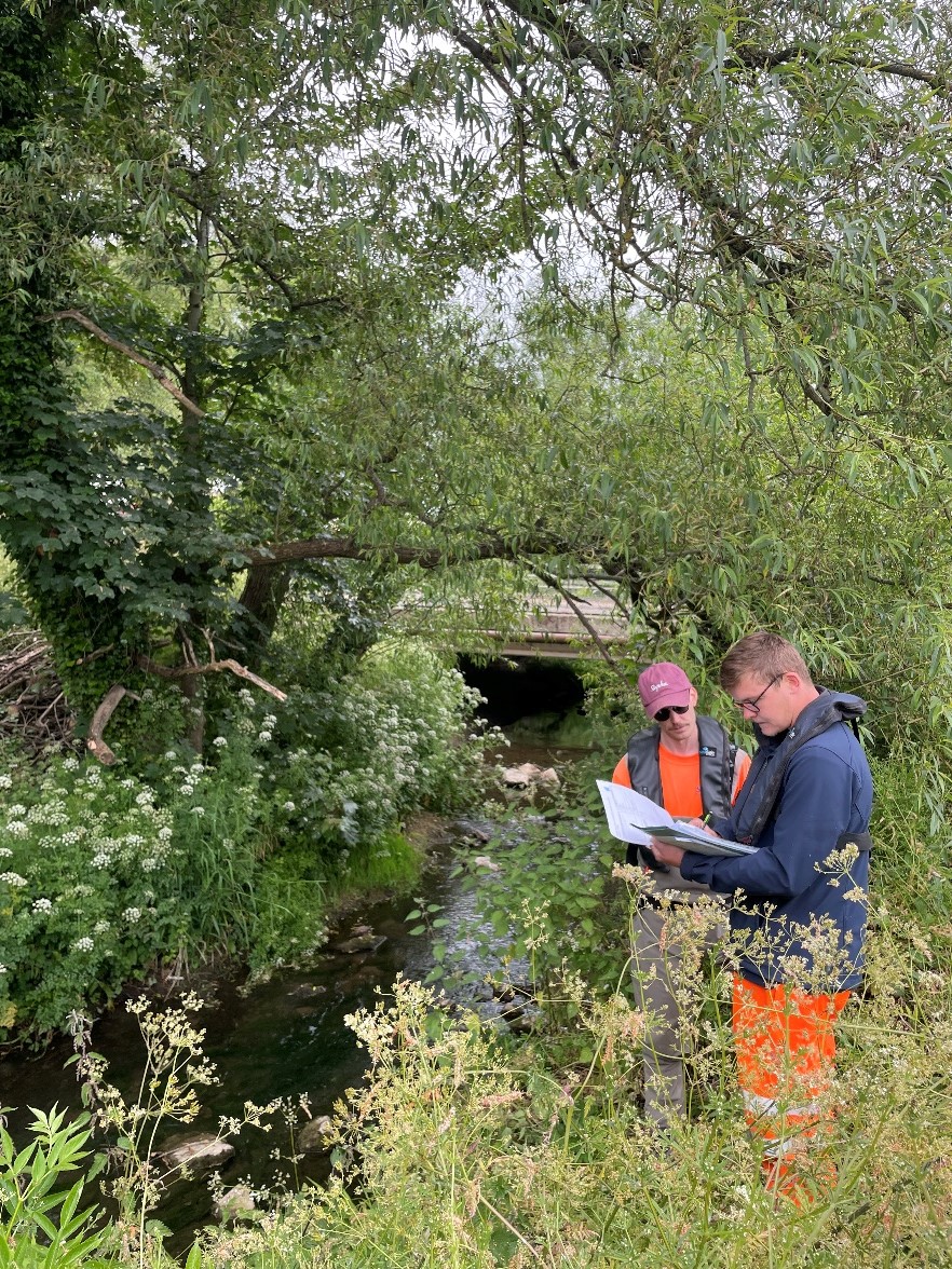
A number of Storm’s river surveyors are qualified to carry out MoRPh river surveys. To assess the impact of the proposed bridge, a baseline River Condition Assessment (RCA) was carried out and then the team modelled scenarios from the baseline to assess the impact of the bridge construction on the preliminary RCA score.
A 400m “typical” reach of the river was selected for the assessment, which encompassed the proposed bridge location; from this a minimum of 20% of the 400m reach was surveyed using ten MoRPh modules; each module covering a river length of 10m. A MoRPh survey takes a detailed look at river condition indicators such as bank top vegetation, channel cross-sectional geometry, bank face vegetation, sediment and water surface patterns – there are thirty-seven indicators in all, some contribute positive values to the final score, others negative. Two groups of five modules (MoRPh5) were recorded, one at the bridge site and another 200m downstream in a location that would provide a typical representation of the river within the 400m reach.
Cross sections were measured using GNSS survey equipment within each survey module to accurately define the channel shape which has a large influence on the final river condition score. A two-person team of water safety trained surveyors entered the river to capture the geometry and inspect the channel related features, all of which would not have been captured had a lone, safety-untrained surveyor observed these indicators from the top of the bank.
Vegetation mass was at its peak at the time of survey, which caused difficulties in moving around the modules and observing ground features, but Storm’s surveyors are well practised in these environments from their core-experience in flood mapping and modelling data capture.
MoRPh5 surveys were then combined with a “MoRPh River Type” desktop survey to produce a preliminary river condition score. The MoRPh river type survey considers factors such as braiding, sinuosity, valley confinement and gradient, which influence how the MoRPh module indicators react in the RCA algorithm. The baseline RCA preliminary score for this section of river was 0.753, which translates to a final condition score/class of “Moderate”. However, the river geometry informed the surveyor that the channel was “over deep” (disconnected from its flood plain) and therefore the class was downgraded to “Fairly Poor”. From the above you can see that the preliminary score is a numerical value, andthe final scoreis a class. Final scores are normally used for the Biodiversity Net Gain calculation, which was not required in this case, so the preliminary score was used.
A bridge design was received from the client and a scenario was run within the RCA online software, which returned a negative impact from the baseline score.
On advice from the surveyor, the bridge design was revised, moving the bridge abutments further away from the bank tops to avoid encroachment into the river channel, which was having a negative impact. The new bridge design was tested, and the score (0.729) was improved but continued to have a negative impact on the baseline preliminary RCA score.
Further work was done by the surveyor to mitigate the negative impact of the proposed bridge by creating more scenarios that considered the river type and the influence of the positive and negative indicators within the MoRPh modules. By running twenty different scenarios – such as introducing large woody debris and planting trees, one very feasible scenario was found to uplift the score to 0.834, which surpassed the baseline score by more than 10%.
The outcome
By using the RCA approach, Storm’s client has presented a measured solution to the planning authority that mitigates the impact of the proposed bridge and is likely to discharge their planning condition. Storm’s RCA qualified surveyors get the satisfaction of improving the condition of another river – a mission they will never stop pursuing.
Find out more about Storm Geomatics here.
Why use a TSA Member?
- TSA members, like Storm Geomatics, undergo thorough scrutiny to ensure they meet the association’s rigorous standards. They are well-trained in various survey methodologies, data collection techniques, and data analysis.
- All TSA members must adhere to high standards of professionalism and ethics in surveying and related services. TSA has an application process that ensures all our members meet specific criteria, providing clients with confidence in the quality of services they will receive.
- Find out more about TSA membership here.