Published: 15 Apr 2026
Geospatial surveyors capture all kinds of data at ground level and beyond. Surveying techniques are used in many projects, in an array of sectors – not just obvious ones such as construction and engineering work, and urban development schemes. Too often they are the unsung heroes of these projects.
In this article, we’re going to look at 10 typical examples of geospatial surveying being used to gather data and inform decisions, designs, planning, legislation, our futures and more…
Utility surveys at planning stage and urban upgrade projects
Underground utilities surveys are among the most useful surveys in the planning stage of construction projects, locating the positioning and depth of various underground services and channels, to ensure that delays and hazards are minimised.
They are also essential in urban upgrade projects, where new technologies are being introduced and installed in built environments. The location of existing services has to be known in order for new technologies – for example fibreoptic broadband or water and sewer upgrades – to be installed underground and aligned with existing routes.
Flood risk management – geospatial expertise needed
One of the biggest concerns about housing development in the UK is the potential use of floodplains and areas prone to waterlogging or flooding for building. Flood risk management is another area where geospatial surveying can be extremely useful at the planning stage, mapping areas of concern and identifying how flooding can be mitigated against, or avoided altogether, by the location of the project.
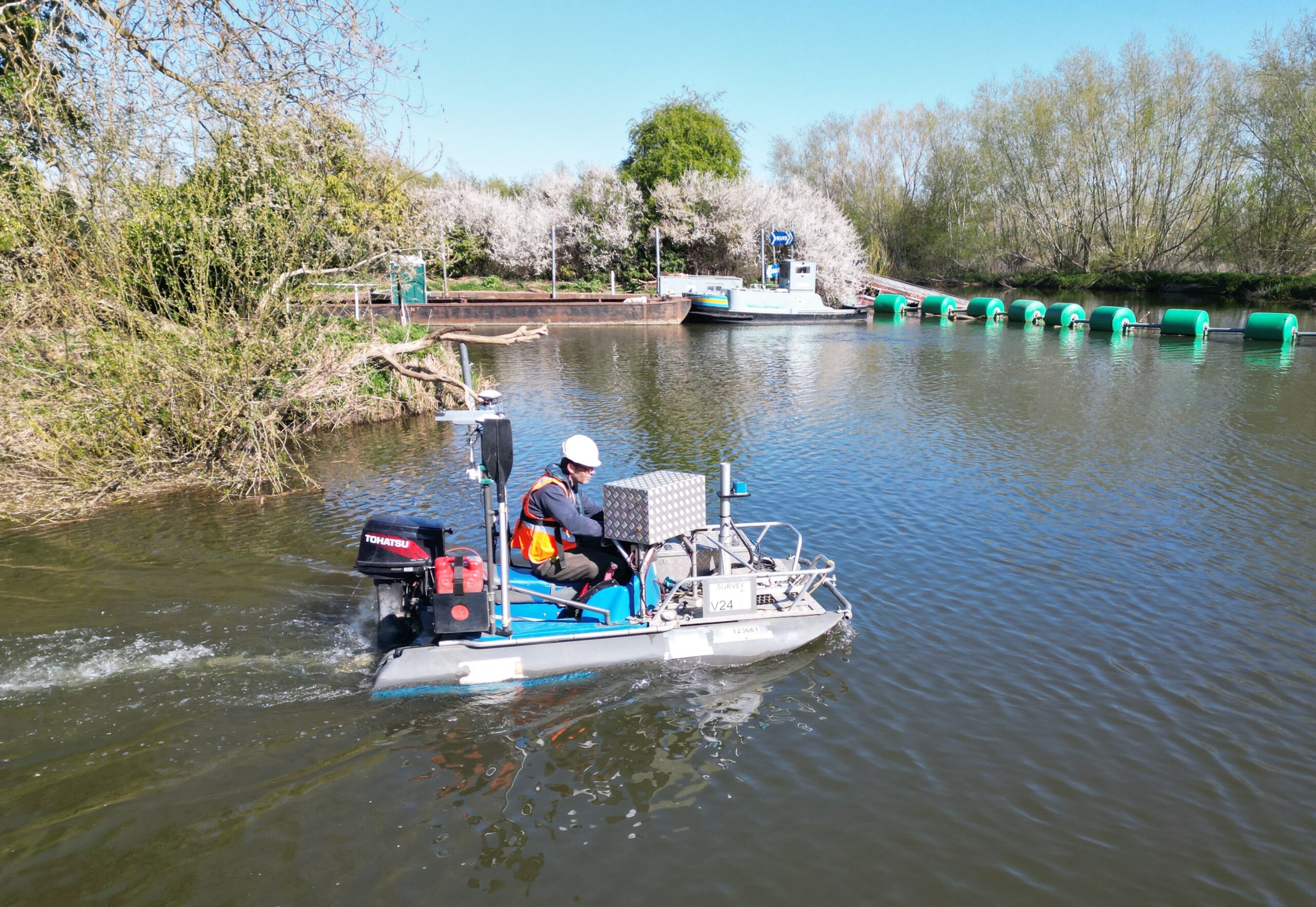
Measuring water resources
Water is also a huge natural resource and its management is an integral part of the UK’s water supply to households and industry. Accurately measuring water resources is an important part of that management process. Hydrographic surveys can measure riverbed levels, or survey reservoir capacities, to provide detailed data for dredge planning and flood/waste modelling too.
Port projects
Hydrographic surveys can also be used in harbour or port projects, to ascertain if safe passage can be achieved for ships, so they will be able to navigate safety to dock. Many estuaries change over time, with silting and other geographical shifts, and monitoring of this using surveying techniques is an essential element of maritime construction.
Coastal protection
Monitoring land near the sea is also a vital part of coastal protection. In instances where coastal erosion and weathering are causing major changes to our coastlines, geospatial surveyors can chart these changes and define the pace of change and measures that will need to be installed, as defence against such land loss.
Trains, traffic and infrastructure
For new rail transportation infrastructure, such as metro links or high-speed rail, geospatial surveying can be used to plan efficient routes, analyse the environmental impact of traffic and manage land acquisition, to be traversed by the tracks.
Bridge construction projects deploy a variety of surveying techniques in their design and construction process – from land surveying of the bridge approaches to underwater surveys of the riverbed’s geography, if pylons or stanchions are going to be required as bridge supports.
The construction of tunnels is one of the most complex types of infrastructure project, whether they are for road or rail routes. A project such as Crossrail would employ 3D modelling and other geospatial technology to monitor the precise boring and construction of underground tunnels, to ensure they integrate with existing infrastructure.
Protecting the environment
Geospatial surveying is essential for environmental protection and conservation work. From tracking deforestation to streamlining land management, surveyors can help to instigate projects such as replanting, to ensure efficiency and sustainability in the landscape are preserved for future generations.