Published: 12 Aug 2026
Photogrammetry has become more accessible than ever. With drones, high-resolution cameras and powerful software now widely available, it’s easier to produce visually impressive models. It is important to understand that not all photogrammetry surveys deliver the same quality or the same level of accuracy. A model might look convincing on screen. That does not mean it can be relied on for design, engineering or construction decisions.
High quality images
Good data begins with good digital images. Higher-quality digital cameras capture more detail, sharper features and less distortion. Images need to be well-focused and consistently exposed too. Poor lighting or inconsistent image quality can reduce clarity. This makes it harder for software to correctly match features between digital photos. This results in reduced accuracy and potentially unreliable outputs.
Planning is critical
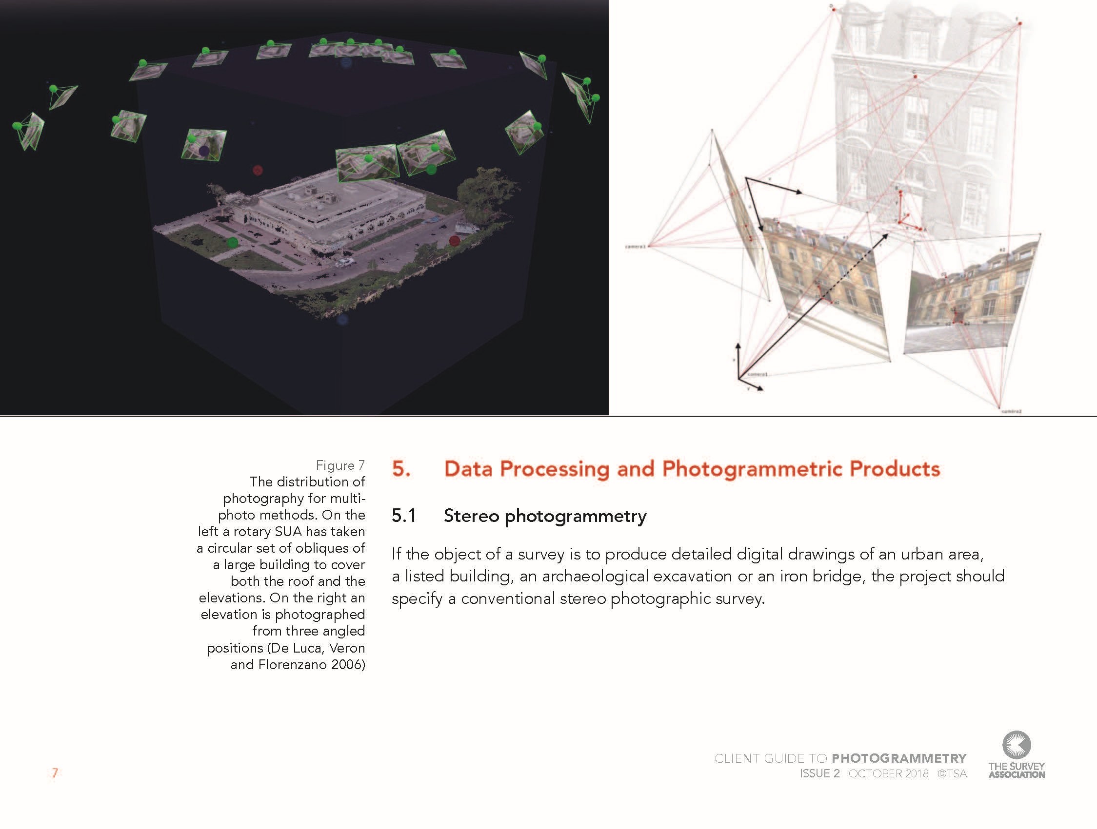
A photogrammetry survey is never simply a case of flying a drone and taking pictures. Successful projects rely on careful planning, including designed flight paths or camera positions, consistent image overlap and appropriate viewing angles. Missing areas or uneven coverage can lead to gaps in the data or distortions in the final model, so getting the coverage right from the start is essential.
Ground control’s important role
One of the biggest differences between a visually impressive model and a survey-grade dataset is the use of ground control points (GCPs). These are accurately surveyed reference points on the ground that anchor the model to real-world coordinates and significantly improve positional accuracy. Without GCPs, a model may look good but lack the accuracy required for precise measurement or integration with other survey data.
The human factor
Despite advances in automation, photogrammetry is still a professional surveying activity. Technology is a powerful tool but it is geospatial survey expertise that ensures the results can be trusted. Experienced geospatial surveyors bring critical expertise, including the skill to plan the survey properly, check and validate results and ensure outputs are fit for purpose.
What about accuracy?
Modern photogrammetry can achieve very high levels of precision, sometimes down to millimetres in ideal conditions. However, this depends on good planning, high-quality imagery and proper control and processing.
What this means for clients
Good photogrammetry is not defined by the technology, it is defined by how it is used. When commissioning a survey, it’s important to look beyond the visuals. Consider how the data will be captured, how accuracy will be controlled and whether the outputs will meet your project needs. A well-executed survey will provide reliable, reusable data. A poorly executed one may need to be repeated, involving delay and extra costs.
TSA is leading a national marketing campaign in a drive to gain greater recognition for geospatial surveying; photogrammetry is just one of the many specialisms of the profession. Found out more about the national marketing campaign and TSA’s Unity Charter here.
For detailed guidance on specifying photogrammetry surveys, understanding accuracy, and choosing the right provider, download the full client guide from TSA’s website. TSA publishes a range of guidance notes on different aspects of surveying – access all our guides here.